

Discover the Trails That Define Kananaskis Country
These six iconic Kananaskis hikes capture everything this mountain region is famous for — turquoise alpine lakes, rugged ridgelines, and panoramic views. Love them or hate them, these are some of the best hikes in Kananaskis Country for good reason.
Over the course of one season, I made it my mission to tackle them all — along with a few bonus trails in between. I didn’t know much about Kananaskis before this trip, but it didn’t take long to realize these were the hikes everyone was talking about.
Some ended up challenging me more than I expected, and a few quickly became personal favourites. We managed a couple on each trip, slowly checking off some of the most legendary Kananaskis trails in the Canadian Rockies.
These routes define what exploring Kananaskis is all about — the vibrant turquoise waters of Grassi Lakes, the sweeping ridges of Pocaterra, and the summit views from Sarrail Ridge that every local knows.
Each one offers something different, from short scenic climbs to full-day mountain adventures, and together they showcase just a few of the many things to do in Kananaskis this beautiful corner of Alberta.
Kananaskis Planning at a Glance
This planning overview is designed to help you organize the most important parts of your trip without overcomplicating things
Want to see where everything is? Access our Kananaskis Google Map
Where to Stay:
Kananaskis Village
Canmore
- Chateau Canmore (mid range)
Adventure Tours:
Book Ahead:
- Kananaskis Conservation Pass
- Rental Car- Discovercars
- Travel Insurance- Safety Wing
- eSIM- Saily
You’ll need a vehicle to reach these trailheads — they’re all located outside the town of Canmore, and a few are over an hour’s drive away. If you don’t have your own car, I recommend renting through DiscoverCars.com; it’s an easy way to compare options and find something that fits your trip.
Some links on this page are affiliate links, which may earn us a small commission at no extra cost to you. We only recommend what we genuinely use or trust. Thank you for supporting our blog.
1. Grassi Lakes – Easy
Grassi Lakes
Distance: 3.5 km
Elevation gain: 150-200m
AllTrails Map

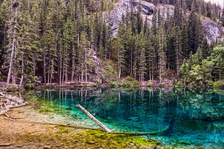
Grassi Lakes was the first hike we tackled on this list. It was our introduction to Kananaskis hiking before we really knew the region. As one of the most iconic and accessible hikes, it’s perfect for beginners or anyone looking for a shorter adventure. The trail winds through forested paths and climbs steadily to reveal two stunning turquoise alpine lakes framed by dramatic limestone cliffs. There are three different routes to the lakes, each offering a slightly different difficulty from easy to moderate.


No matter which route you take, the upper and lower lakes are ideal for a relaxing stop. There are plenty of photo opportunities and space to enjoy a picnic. For those seeking a bit more adventure, a short scramble near the upper lake provides elevated views over Canmore and the surrounding Bow Valley. You also have a high chance of spotting mountain goats. With its combination of easy access, breathtaking scenery, and iconic status, Grassi Lakes is a must-do hike for anyone exploring Kananaskis.
Free Kananaskis Google Map
Packed with all our favourite hikes, scenic stops, and hidden gems, this free interactive map also includes trail stats, colour-coded difficulty ratings, photos, and personal notes to help you plan your trip more efficiently.

- Kananaskis regions
- Hiking trailheads
- Lakes
- waterfalls
- Scenic viewpoints
- Campgrounds & day-use areas
- Services & information centres
- Hidden gems & local favourites
2. Mist Mountain Hot Springs – Moderate
Mist Mountain Hot Springs
Distance: 6.6 km
Elevation gain: 583 m
AllTrails Map

Whenever I go somewhere new, I like to ask the locals what I need to see. In Kananaskis, the must-see recommendation was Mist Mountain. Joshua, Sarah, and I made the steady climb through the forest to a sweeping alpine meadow surrounded by rugged peaks. Instead of pushing all the way to the summit, we stopped at the natural hot springs about halfway up the mountain. Warm mineral water collects in a small rocky pool with panoramic views of the valley below. It’s one of the few places in Alberta where you can soak in a wild hot spring after earning it with a good climb.


The route to the springs is steep but manageable for intermediate hikers. Expect a mix of loose rock, steady elevation, and strong mountain wind once you’re above the treeline. There’s a short section right before the pools that’s particularly steep and slippery, so good hiking shoes and poles are a must. The reward is more than worth it — a scenic soak with the dramatic backdrop of Mist Mountain towering overhead. The full summit is a challenging scramble, but even without reaching the top, this trail captures the adventurous spirit of Kananaskis.

📌 Pro Tip: Bring a swimsuit and towel, so you can have a soak at the top. The ridge line can be very windy and cold even in summer, so bring a windproof outer layer.
3. Ha Ling Peak – Moderate to Challenging
Ha Ling
Distance: 7.6 km
Elevation gain: 795 m
AllTrails Map

Ha Ling was my first solo mountain peak. The trail starts climbing almost immediately, gaining 800 m of elevation in just 3.9 km. It’s a true test of uphill endurance. Once you clear the treeline, sweeping views of the valley open up below. From there, it’s a steady grind up stairs and across loose rock to the final ridge.
The last 300 meters of the trail are unmaintained and turn into a “choose your own adventure” route over loose scree and high winds. Pick the line that feels safest for you and take your time on the way up. From the summit, you can see Canmore stretched out below and the surrounding peaks rolling off in every direction. Don’t forget to look for the turquoise shimmer of Grassi Lakes far below — the perfect way to connect two Kananaskis classics.


Expect strong winds and a busy trail, especially on weekends. Ha Ling is one of the most popular hikes in Kananaskis for good reason, offering some of the best views near Canmore. This trail delivers everything people imagine when they picture hiking in the Canadian Rockies — steep climbs, rugged ridgelines, and panoramic views, all packed into a short half-day adventure.
4. East End of Rundle (EEOR)
EEOR
Distance: 5.3 km
Elevation gain: 795 m
AllTrails Map
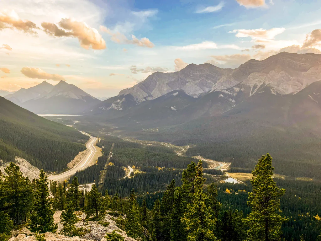
Don’t let the short distance fool you. East End of Rundle (EEOR) packs nearly 800 metres of elevation gain into a 5.6 km round-trip hike, making it one of the most demanding short hikes near Canmore.
The trail climbs steeply through forest before opening onto rocky slopes, loose scree and increasingly spectacular views of Canmore and the Bow Valley. Unlike its neighbour Ha Ling, EEOR has no constructed staircases or well-maintained switchbacks to ease the climb. Some sections require scrambling, and route-finding can be challenging near the summit.
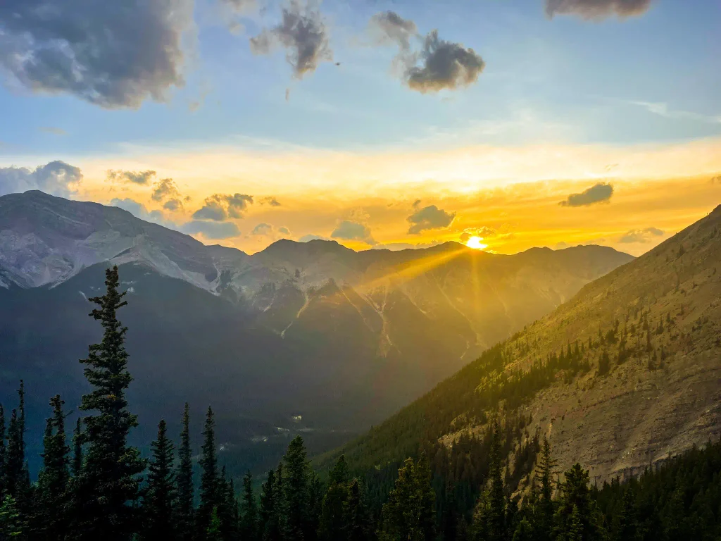
I hiked EEOR solo for sunset, after tackling Ha Ling earlier that day. That made for a lot of elevation gain in one day, but the evening views were worth the extra effort. However, it also meant descending in the dark, which added another layer of difficulty to an already challenging hike. If you’re planning a sunset hike, bring a reliable headlamp and be prepared to navigate the trail in the dark.
This classic Canmore scramble is best suited to experienced hikers who are comfortable with loose rock, steep terrain and some exposure. Trekking poles are especially helpful for the steep, loose descent. Don’t underestimate it simply because of its short distance.
📌 Pro Tip: Download an offline trail map before starting. The route isn’t always obvious, particularly near the summit.
5. Pocaterra Ridge – Moderate to Challenging
Pocaterra Ridge
Distance: 9.8 km
Elevation gain: 861 m
AllTrails Map

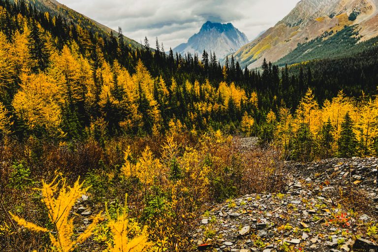
Pocaterra Ridge is one of my all-time favourite hikes in Kananaskis — and my favourite on this list. The trail has everything: rolling ridgelines, sweeping alpine views, and endless photo opportunities. It’s also one of the best larch hikes in Kananaskis, when golden trees light up the valleys each fall. If you’re visiting in September, this trail should be at the top of your list.


The trail is very busy, especially on weekends and during larch season. It can be done as either a point-to-point route or an out-and-back, depending on your logistics. The point-to-point version starts at Highwood Pass and finishes at Little Highwood, offering more variety and fewer crowds after the initial climb. Most hikers turn back once they reach the ridge, but hiking the full route rewards you with solitude and sweeping views across the Highwood Range.
No matter which option you choose, the scenery is spectacular. The trail winds through alpine meadows and climbs to several high points with panoramic views of Mount Pocaterra and the surrounding peaks. This hike not only captures the essence of Kananaskis but also reminds you that Canada is home to some world-class mountain beauty.
6. Rawson Lake + Sarrail Ridge – Challenging
Rawson Lake + Sarrail Ridge
Distance: 12.4 km
Elevation gain: 1073 m
AllTrails Map

Sarrail Ridge was my first Kananaskis peak, and the climb immediately showed me what the region is capable of. The climb up Sarrail was a physical and mental battle — it was early in the season, and I had forgotten my poles. Big mistake!
The hike begins with a steady climb to Rawson Lake, which is a rewarding, moderate hike. From Rawson, Sarrail Ridge continues with a steep, slippery ascent to the summit. Trekking poles are essential for both the ascent and the descent. Hikers without poles were clinging to anything they could to avoid sliding down. These are my recommended trekking Poles.
Hiker Hunger Trekking Poles 👉 Buy at: Amazon


From the ridge, the views are breathtaking. On one side, you can see Upper and Lower Kananaskis Lakes; on the other, Rawson Lake — all framed by rugged peaks. The combined trails include forested sections, alpine meadows, and open ridge walking, giving a full spectrum of Kananaskis scenery.
The ascent is punishing, but the dramatic vistas make the hike unforgettable and a must-do for anyone aiming to tackle a classic Kananaskis peak.
If hikes around the Kananaskis Lakes are high on your list, choosing the right campground can put you much closer to the trails you want to explore.
7. Tent Ridge Horseshoe- Challenging
Tent Ridge Horseshoe
Distance: 10.5 km
Elevation gain: 781 m
AllTrails Map
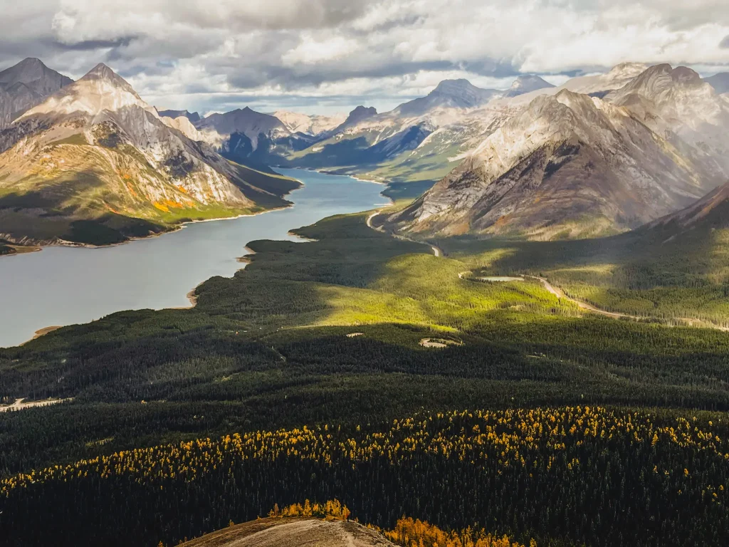
Tent Ridge is one of the most spectacular ridge hikes in Kananaskis, with panoramic views of Spray Lakes Reservoir and the surrounding mountains. Much of the hike follows an exposed ridgeline, making it a fantastic choice for experienced hikers who enjoy big mountain views.
⚠️ Safety Note: Tent Ridge has extensive exposed terrain and scrambling sections. A hiker tragically died here in August 2026 following severe weather.
Conditions can change rapidly, even when it’s mild at the trailhead. Check the forecast, prepare for unpredictable weather and carry a satellite communicator, as cell service is unreliable.
I hiked Tent Ridge on the final morning of my fall trip to Kananaskis, before heading home. I’d chosen Tent Ridge partly for the fall colours. Although there were some beautiful larch views, the sweeping mountain scenery was the real highlight.
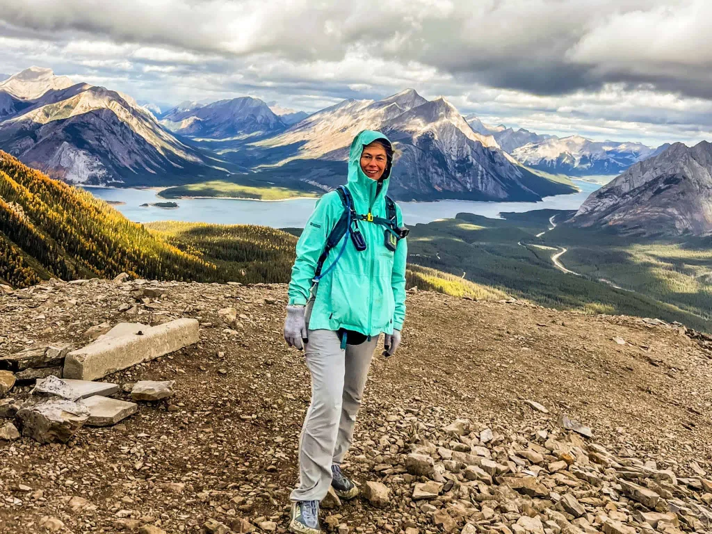
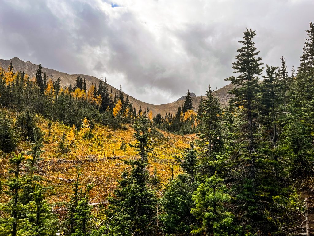
When I was hiking the wind whipped along the ridge, making me glad I had packed extra layers. Just a friendly reminder that knowing how to layer for hiking is especially important in the mountains. I also encountered a little rain, but the rainbow that appeared over the mountains was a welcome surprise.
📌 Pro Tip: Bring a toque, gloves and a windproof layer, even if the forecast looks mild. The long, exposed ridge offers little shelter, and you could encounter strong winds, rain, fog or even snow. Be prepared for conditions that are much colder and harsher than those at the trailhead.
ℹ️ Helpful Hints for Hiking in Kananaskis
- A Kananaskis Conservation Pass is required to park a vehicle anywhere in Kananaskis Country. Buy your pass online or at any Kananaskis information center.
- Mountain weather changes quickly. Know how to layer clothing to be prepared for any weather.
- Be bear smart and stay safe: Kananaskis is bear country. Know how to stay safe when hiking in bear country
- Remote trails and emergency communication: Many hikes are in areas with no cell service. Consider carrying a satellite communication device to stay in touch or request help if needed.
- Wear sturdy shoes: Some trails include steep ascents, loose scree, and slippery descents. Good traction is essential. Our favourite hiking shoes are:
- Dress for wind and cold: Even in summer, ridges and peaks are chilly. Bring a windproof outer layer.
- Fuel up: Pack snacks for energy. Know how to fuel for sustained energy.
Final Thoughts on Kananaskis’ Iconic Trails
Kananaskis is full of hiking legends, and these five signature trails capture everything that makes the region so special — turquoise alpine lakes, rugged ridges, and jaw-dropping views. Whether you’re seeking a gentle introduction at Grassi Lakes or the challenge of Sarrail Ridge, each hike offers a memorable adventure and a taste of the Canadian Rockies at their finest.
Plan your hikes, pack wisely, and take your time to enjoy the scenery — these trails aren’t just paths, they’re experiences. I can’t say it enough: we are blessed beyond measure to explore the depths of the Lord’s creation. He has gifted us with breathtaking landscapes to savour that allow us to immerse ourselves in His mercy and grace.