Understanding Where to Stay, Hike, Camp, and Explore in Kananaskis
Kananaskis is one of those places that feels overwhelming at first and addictive once you start exploring the landscape. After years of visiting the major national parks in the Canadian Rockies, we finally made our first trip to Kananaskis Country last year. Since then I’ve been back three more times. This Kananaskis travel guide will breakdown everything I learned during those trips.
Honestly, when I planned the first trip, I had no idea how Kananaskis actually worked. It was close enough to home that I didn’t do my ususal pretrip research.
As a result, I didn’t understand how Kananaskis Country related to Canmore, where the different regions were (or even that there were different regions), how far apart everything was, or where we should base ourselves while exploring the area.
We showed up with no real plan beyond a few hikes saved on AllTrails and a general idea that Kananaskis was “somewhere near Banff.” We didn’t even have a reservation for our first night!
I quickly discovered that a trip to Kananaskis does indeed require some planning to make the most of your time there. It is a massive region filled with different hiking areas, scenic drives, campgrounds, alpine lakes, and a diverse mix of mountain experiences. They all connect together in ways that can be surprisingly hard to understand if you don’t spend a bit of time learning the area before you go.
It took me three trips to fully learn my way around the region, and that learning curve is why I created this Kananaskis travel guide. My goal is to help you confidently plan a trip to Kananaskis — whether you’re looking for iconic alpine hikes, quieter trails, scenic campgrounds, or simply a more active way to experience the Canadian Rockies.
Kananaskis Planning at a Glance
This planning overview is designed to help you organize the most important parts of your trip without overcomplicating things
Want to see where everything is? Access our Kananaskis Google Map
Where to Stay:
Kananaskis Village
Canmore
- Chateau Canmore (mid range)
Adventure Tours:
Book Ahead:
- Kananaskis Conservation Pass
- Rental Car- Discovercars
- Travel Insurance- Safety Wing
- eSIM- Saily
Some links on this page are affiliate links, which may earn us a small commission at no extra cost to you. We only recommend what we genuinely use or trust. Thank you for supporting our blog.
What You Need to Know Before You Go
Planning a trip to Kananaskis Country doesn’t have to be difficult, but it does help to understand how the region works before you arrive- a lesson I learned the hard way. Once I started understanding how the different areas connected together, planning hikes, campgrounds, and driving routes became much more straightforward.
Kananaskis Conservation Pass
A Kananaskis Conservation Pass is required for vehicles parked in Kananaskis Country. The pass helps fund infrastructure, maintenance, visitor services, and conservation throughout the region.
There are two pass options:
- a daily pass that costs $15 per day, is valid for one vehicle, and expires at 11:59 PM on the day it was purchased
- an annual pass that costs $90 and is valid for one year from the date of purchase. The annual pass can be used on up to three vehicles registered to the same address.
Passes can be purchased online ahead of time or at visitor information centres throughout the region.
Limited Cell Service
Cell service is extremely limited outsisde of the main towns of Canore and Kananaskis Village. There are large stretches that have no service including entire campgrounds, highways, and and trails.
- Download trail maps on AllTrails or Gaia GPS ahead of time
- Download Google Maps
- It’s recommended to carry a satellite communicator in case of emergency
- Screenshot reservations
- Purchase Kananaskis Conservation Pass before arriving at campground
You’ll Need a Vehicle to Explore Kananaskis
Unlike Canmore, there is no public transportation to or through Kananaskis Country. Most trailheads, campgrounds, lakes, and scenic areas will require driving, and locations can be an hour’s drive or more apart from each other. Although most areas can be reached via well maintained highways, the Smith Dorrien corridor follows a notoriously rough gravel road.
Generally speaking a 4×4 is not required during summer, but personal transportation is necessary for a smooth visit.
🚗 Kananaskis Car Rental
Having your own vehicle will make exploring Kananaskis country much easier and more efficient.
We like to compare prices through both Expedia and Discovercars.com to find the best deal.
Fuel Stops in Kananaskis
Although Canmore has plenty of gas stations, there are only two in Kananaskis. One is at the junction of Highway 40 and the Trans Canada Highway, while the other is further south along Highway 40. All the gas stations in both Canmore and Kananaskis are significantly more expensive than outside the region.
On our first three trips we gassed up at Chiniki Gas bar, about 10 minutes east of Highway 40. Gas was consistently 10-15 cents per litre cheaper there. However on our last trip out, they were out of fuel, so I reccommed planning your gas stops wisely.
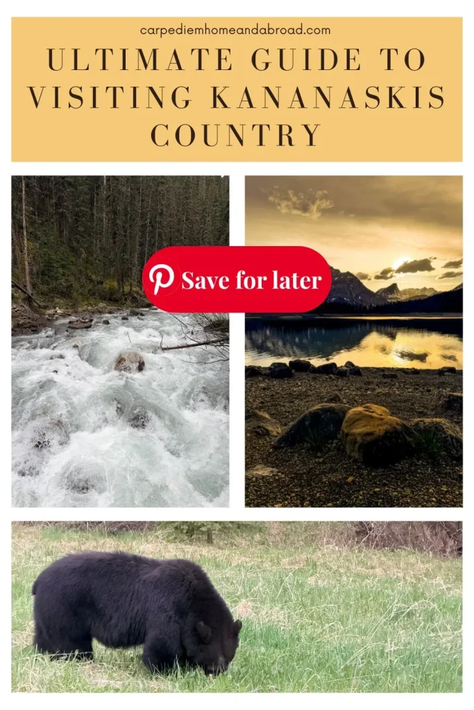
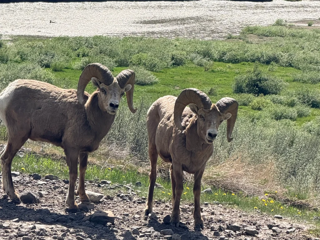
Kananaskis is Bear Country
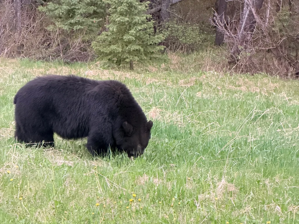
Kananaskis Country is active wildlife habitat, and wildlife sightings are a normal part of exploring the region. Bears, elk, bighorn sheep, mountain goats, and deer are all commonly seen throughout Kananaskis. Understanding bear safety is essential to a safe Kananaskis trip.
When hiking in the area:
- carry bear spray
- know how to use it
- make noise on trails
- keep dogs on a leash at all times
- Never approach or try to feed any wildlife
When camping in the area:
- Never bring food into your tent
- Store food in your vehicle
- Wash dishes and put food away as soon as you finish eating
Most travellers in Kananaskis are completely safe every day, but preparation and awareness are simply part of travelling responsibly in the Canadian Rockies. If you’re new to travelling in bear country, understanding basic wildlife safety and how to respond during a wildlife encounter is an important part of planning your trip.
Wildlife Sightings Are Common
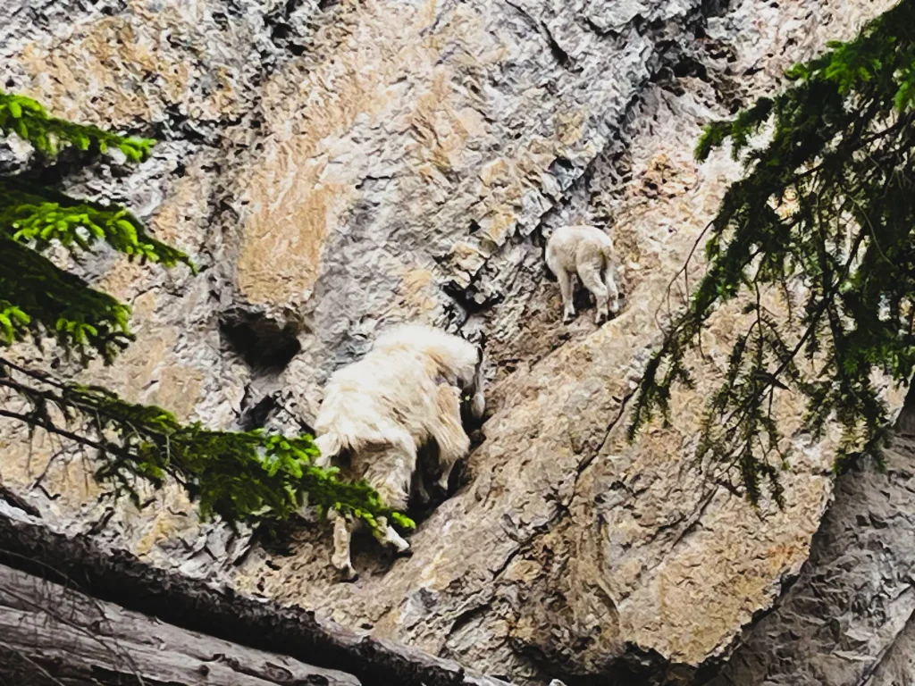
The wildlife is a big part of what makes Kananaskis feel wild and memorable. It’s common to see elk, deer, bighorn sheep, mountain goats, and occassionally bears throughout the region.
If you spot wildlife:
- give animals plenty of space and do not try to approach or feed
- slow down if driving
- avoid stopping in unsafe places on the highways
Wildlife traffic jams are common during peak summer times. If you see a line of vehicles pulled over, there’s likely an animal nearby.
Mountain Weather Changes Quickly
Weather in Kananaskis Country can change quickly, especially at higher elevations and along ridge lines. Sunny days can easily turn to rain, high winds, smoke, or much cooler temperatures later in the day or along ridges and summit peaks. Understanding how layers work will help you stay warm and safe while you visit.
Even during summer it’s worth bringing:
- extra layers
- rain gear
- proper footwear
Conditions in different parts of Kananaskis Country can vary also.
Understanding the Different Areas of Kananaskis
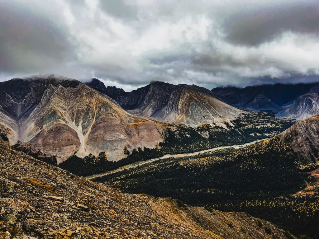
One of the biggest challenges when planning a trip to Kananaskis Country is that Kananaskis isn’t one town, one park, or one clearly defined destination. The region stretches across 4000 square km (1500 square miles) and includes multiple provincial parks, mountain highways, campgrounds, lakes, and hiking areas that all offer very different experiences.
Understanding how the different areas fit together can make a huge difference in choosing where to stay, which hikes to prioritize, and how much driving to realistically expect during your trip.
Highway 40 Corridor
Highway 40 is the drive that made Kananaskis finally start to make sense to me. Running south from the Trans-Canada Highway toward Highway 541, it connects many of the lakes, hiking areas, campgrounds, and mountain landscapes that make up the heart of Kananaskis Country.
Some of my favourite areas in Kananaskis are found along this highway, from iconic alpine hikes like Pocaterra Ridge and Mist Mountain to easier-access stops like Barrier Lake and Mount Lorette Ponds.
Further south along Highway 40 is where you’ll find several of my favourite off-the-beaten-path hikes in Kananaskis, including Mist Mountain, Picklejar Lakes, and Cat Creek Falls.
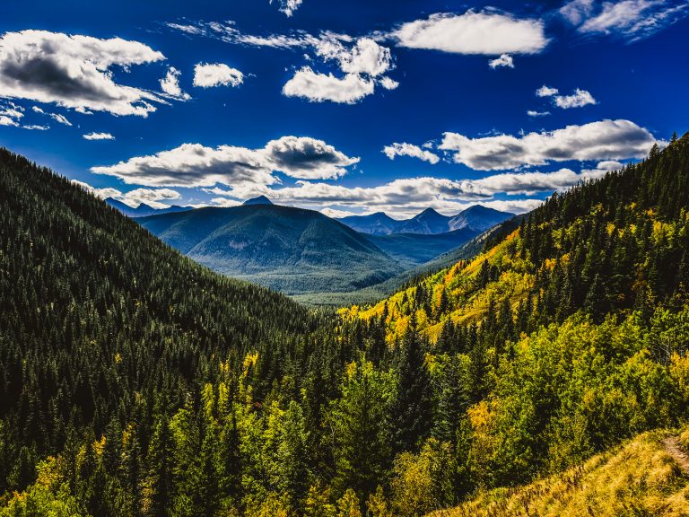
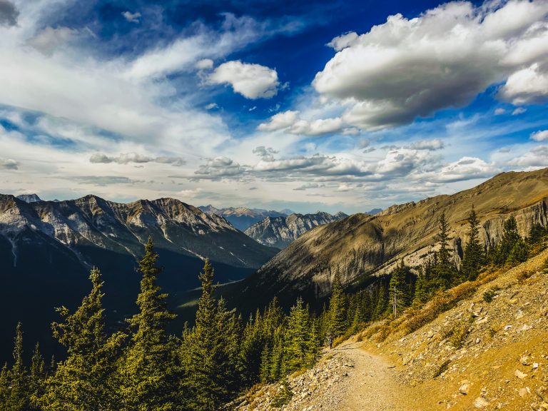
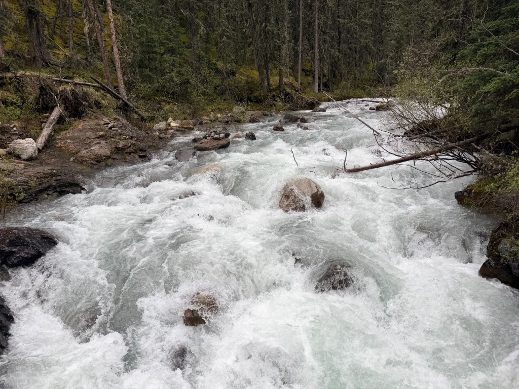
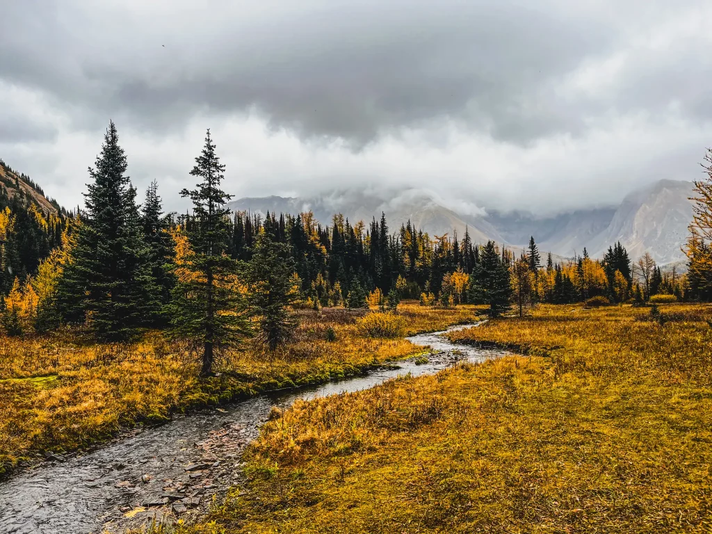
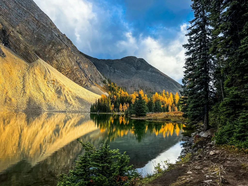
The scenery changes constantly along the drive, passing forests, rivers, mountain valleys, alpine lakes, and open slopes that explode with wildflowers in summer and golden larches in the fall.
Wildlife sightings are also a huge part of the experience along Highway 40. It’s common to see bighorn sheep, elk, deer, and occasionally bears along the roadside or near hiking areas, especially early and late in the day.
Bow Valley
The Bow Valley forms much of the northern section of Kananaskis Country, wrapping around the Canmore area and connecting several of the region’s most accessible hiking and recreation areas. Highway 40 begins in this area before continuing deeper into Kananaskis toward Peter Lougheed Provincial Park, Highwood Pass, and the southern parts of the region.
This was the area we explored during our first trip to Kananaskis, and it ended up being a great introduction to the region. Honestly we’ve hit at least one place in Bow Valley on every trip. because of how many different types of hikes and outdoor experiences are concentrated nearby.
Popular hikes and recreation areas in the Bow Valley include:
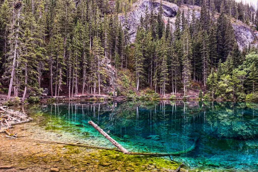
- Grassi Lakes
- Ha Ling
- EEOR
- Grotto Canyon
- Barrier Lake
- Troll Falls
- Mount Lorette Ponds.
With everything from short interpretive walks to challenging summit hikes and scrambles, the Bow Valley offers outdoor experiences suitable for a wide range of abilities and adventure levels.

Because many trailheads and day-use areas are located relatively close together, the Bow Valley works especially well for day trips, shorter adventures, and first-time visits to Kananaskis.
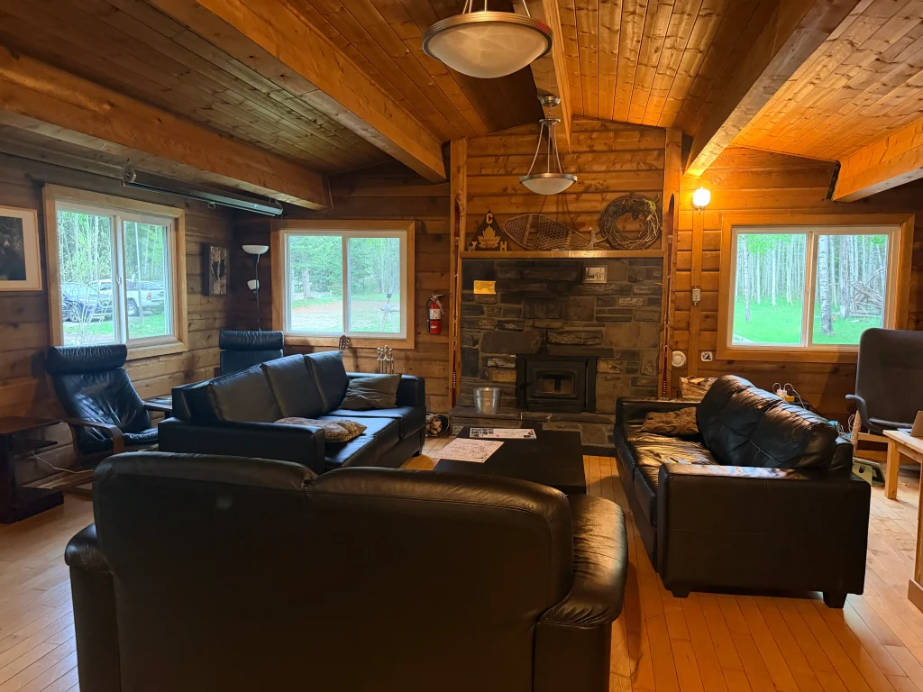
Kananaskis Village
🏨 Where to Stay in Kananaskis Village
HI Kananaskis Wilderness Hostel – budget-friendly
Sundance by Basecamps– Budget-friendly; glamping
Pomeroy Kananaskis Mountain Lodge– Luxury
Kananaskis Village is a small mountain resort village just off Highway 40 that many travelers use as a base when exploring Kananaskis Country. While some areas farther south are more campground-oriented, Kananaskis Village includes
- accommodations for a wide range of budgets
- dining options,
- spa experiences,
- a golf course
- access to a few beginner-friendly trails.
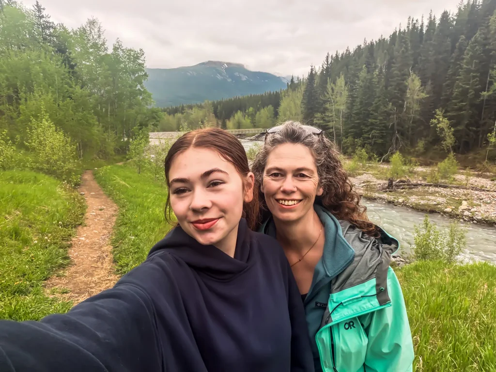
On our last trip to Kananaskis, we stayed at the HI Kananaskis Wilderness Hostel. My mom came with us and had some serious reservations about staying in a hostel, but by the time we left, she was completely won over. If you’re looking for a quality budget-friendly stay in Kananaskis, this is an excellent option. The hostel has everything you need, including clean bathrooms, a cozy common area, and a large shared kitchen, with both private and dorm-style rooms available.
Peter Lougheed Provincial Park
Peter Lougheed Provincial Park is where we’ve spent the majority of our time since our first trip to Kananaskis Country, and it’s still one of my favourite parts of the region. This area is home to some of my favourite Kananaskis hikes and day use areas including:
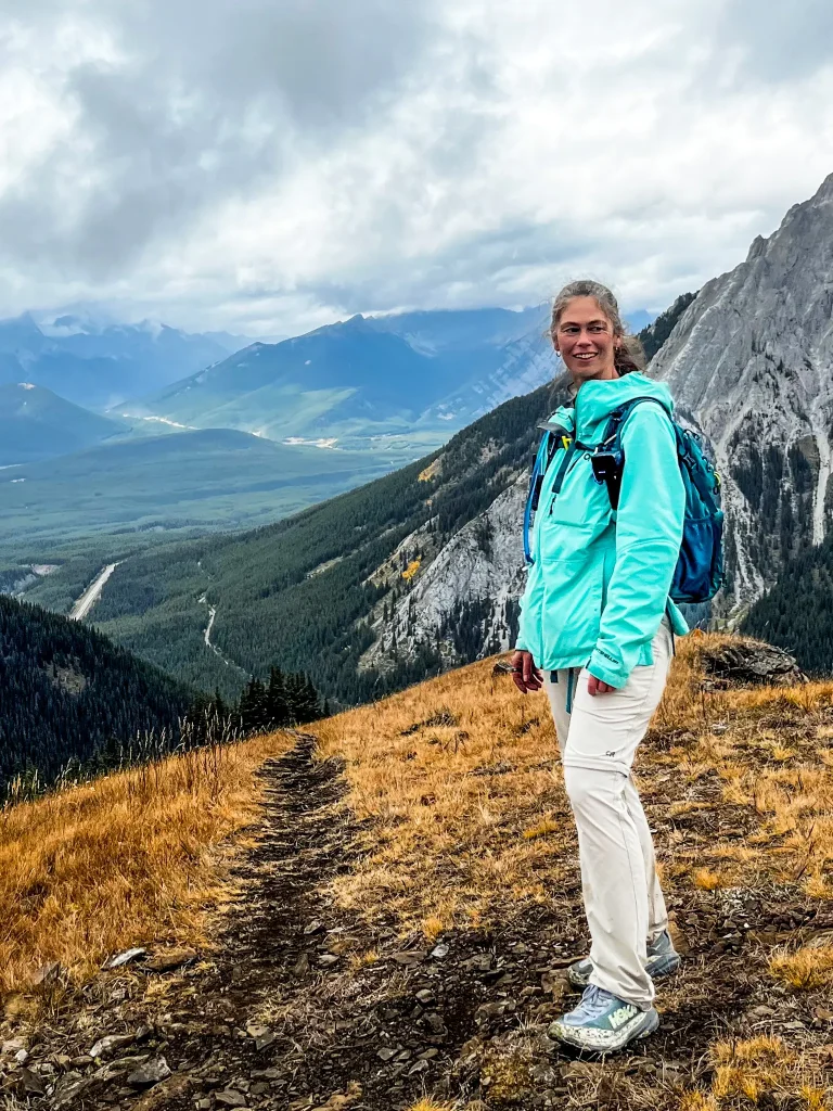
- Pocaterra Ridge
- Sarrail Ridge via Rawson Lake
- Upper Kananaskis Lakes

Unlike areas closer to Canmore, Peter Lougheed feels much more centered around hiking, camping, paddling, and spending full days outside. Accommodations here are mostly limited to campgrounds, which is part of what gives the area a quieter and more immersive feel.
Boulton Creek is where we’ve stayed most often because of its central location within the park and convenient access to hiking trails, lakes, and day-use areas throughout Peter Lougheed Provincial Park. It also has a small camp store and Wi-Fi, which can be surprisingly helpful since there is essentially no cell service anywhere in the area.
Interlakes Campground is another beautiful option in the area, with several campsites sitting directly along the shoreline of Lower Kananaskis Lake.
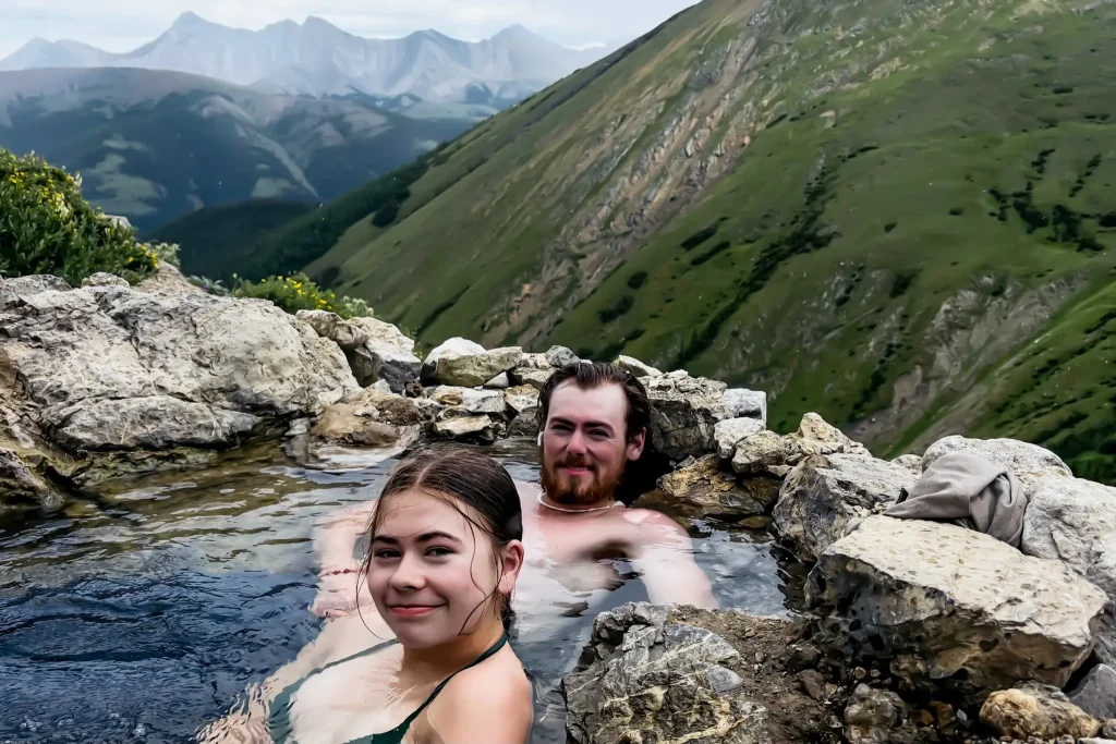
Spray Lakes and Smith Dorrien Area

On our first trip to Kananaskis Country, we stayed at Spray Lakes West Campground along the Smith-Dorrien Trail. This area feels noticeably more remote than other parts of Kananaskis, with rugged mountain scenery, gravel roads, no services, and a much quieter atmosphere once you leave the Canmore area behind.
The Smith-Dorrien Trail, also known as Highway 742, is a long gravel road running from the west side of Canmore through the Spray Lakes region before eventually connecting with Highway 40 in the southeastern part of Kananaskis. While the drive is scenic, visitors should be prepared for rough road conditions and no cell service throughout the corridor.
Some of my favourite hikes in this region include Chester Lake and Tent Ridge, both of which showcase the dramatic mountain scenery and alpine lake views that make this part of Kananaskis so memorable.
Accommodation options in the area are fairly limited. Spray Lakes West Campground is scenic and well located, but visitors should know there is no potable water, no cell service, and very few facilities along the route itself. For travelers wanting a more comfortable stay, Mount Engadine Lodge is an all-inclusive luxury stay in the heart of Spray Lakes’ backcountry.
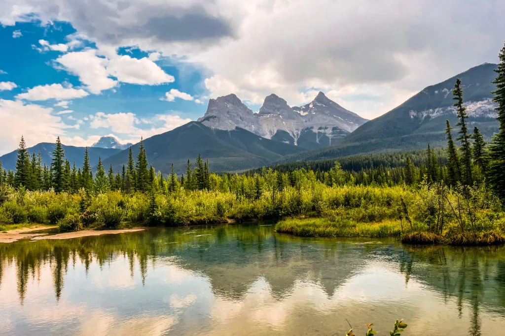
Canmore
Although Canmore is not part of Kananaskis Country, it is one of the most popular places to stay when exploring the region. Sitting directly beside the northern edge of Kananaskis, Canmore offers far more accommodations, restaurants, grocery stores, and amenities than any area inside Kananaskis.
Because Canmore is outside Kananaskis Country, you do not need a Kananaskis Conservation Pass while parked in town. However, the pass is still required once you begin parking at Kananaskis trailheads, day-use areas, and recreation sites, including nearby locations like popular Grassi Lakes.
While all of my favourite mountain experiences in the region have been farther out in Kananaskis itself, Canmore works extremely well as a convenient basecamp for exploring the surrounding area. The town still has several scenic walking and hiking areas nearby, including the Three Sisters viewpoint areas, Benchlands Ridge, and hikes like Lady MacDonald overlooking the Bow Valley.
For travelers wanting easier access to restaurants, grocery stores, coffee shops, and a wider range of accommodations while still spending most of their time outdoors, Canmore is the easiest place to base yourself.
Best Time to Visit Kananaskis
The best time to visit Kananaskis Country really depends on the type of trip you want to have. We’ve visited during late spring, summer, and fall larch season, and every trip has felt completely different from the last.
Summer
Summer is the most popular time to visit Kananaskis and generally offers the best access to hiking trails, campgrounds, paddling areas, and mountain roads. Most higher elevation hikes are snow-free by mid to late summer, and long daylight hours and stable weather make it easier to combine multiple stops into the same day.
This is the best season for:
- camping
- alpine hiking
- paddling
- scenic drives
- full-day outdoor adventures
The downside is that popular areas can become extremely busy, especially on weekends.
Fall & Larch Season
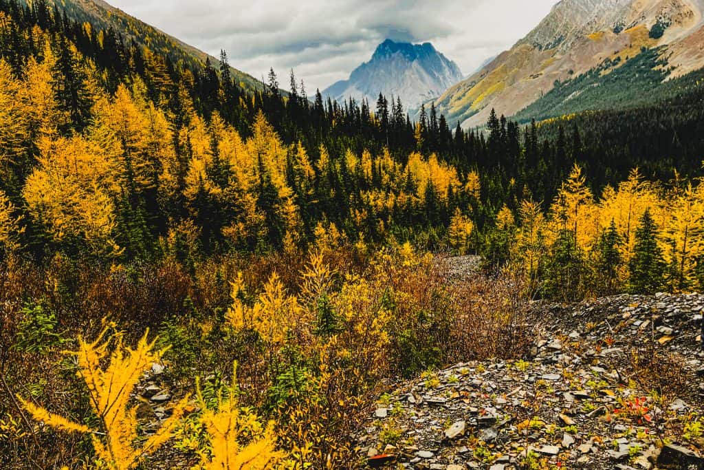
Fall is one of the most beautiful times to visit Kananaskis Country, with cooler temperatures, changing colours, quieter trails, and excellent hiking conditions throughout much of the region.
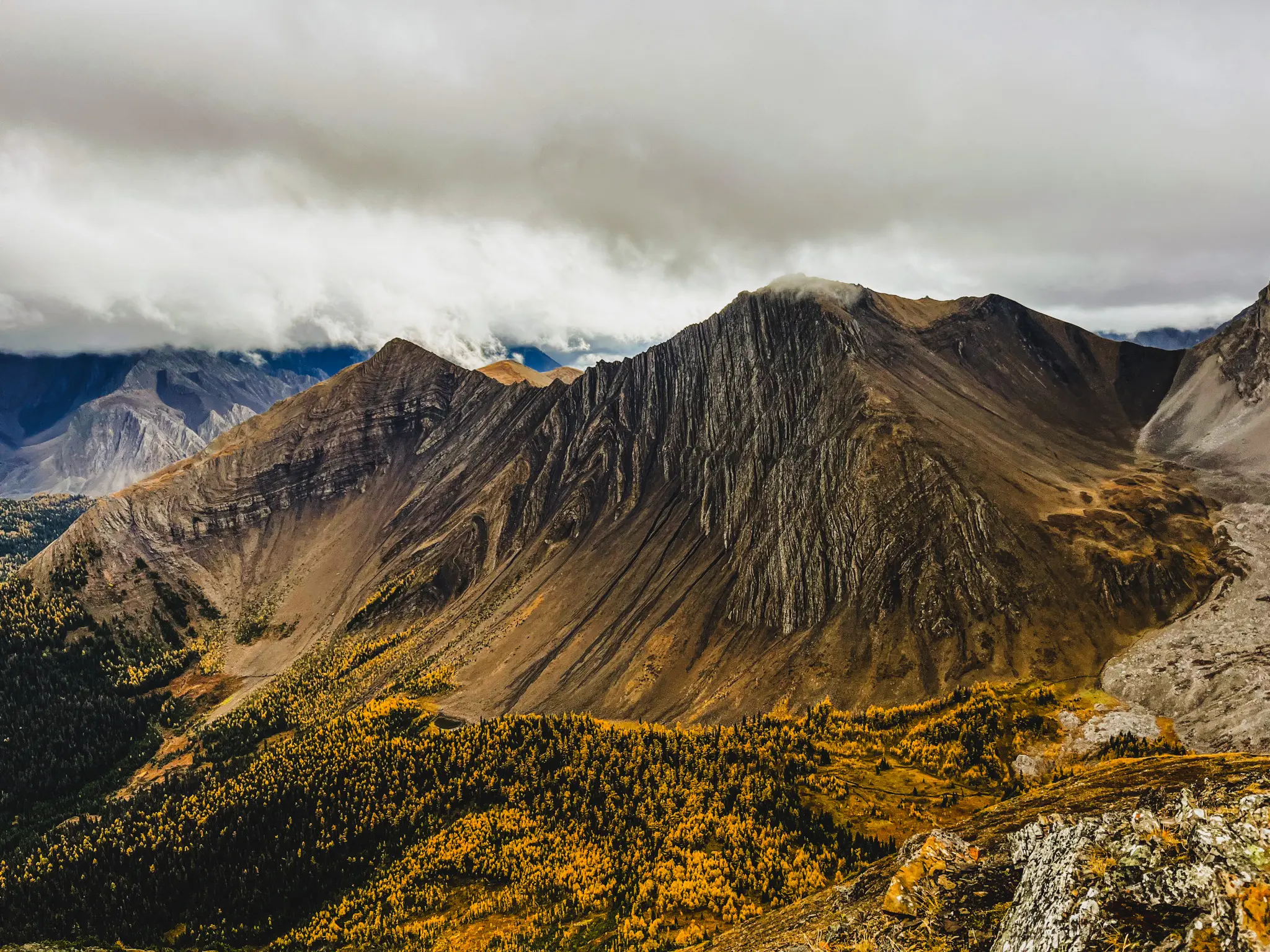
Having said that, the most popular time of the entire year is larch season, when alpine larch trees turn brilliant shades of gold that contrast with the dark green foliage. Peak larch season is approximately 2 weeks, usually from mid September to early October (exact dates vary each year depending on the weather conditions).
Some of the most popular larch hikes include:
- Pocaterra Ridge
- Arethussa Cirque
- Ptarmigan Cirque
- Chester Lake
Parking lots can be completely full by 9 AM, so early starts and mid week hikes are recommended if you enjoy quieter trails.
Fall weather can feel much cooler than visitors expect, especially early mornings and evenings. Packing layers, along with a toque (beanie) and gloves can be a real lifesaver during fall trips.
Winter
I haven’t personally visited Kananaskis during the winter yet, but the region is popular for downhill skiing and snowboarding at Nakiska Ski Area, which was originally built for the alpine skiing events at the 1988 Calgary Winter Olympics. Other popular activities include snowshoing, cross-country skiing, winter hiking, and mountain getaways.
Winter access in Kananaskis also changes significantly once snowfall arrives. Highway 40 south of Peter Lougheed Provincial Park closes seasonally from December 1 to June 15, limiting access to some southern parts of the region during the winter months. Many campgrounds and seasonal facilities also close for the winter.
However, the Smith-Dorrien Trail remains open year-round, although road conditions can vary significantly depending on snowfall and weather conditions. If you plan to visit during winter, checking road conditions, trail reports, and weather forecasts before heading into the mountains becomes especially important.
Spring
Spring in Kananaskis Country can feel very different depending on elevation and recent weather conditions. Lower elevation areas around the Bow Valley often begin melting out much earlier, while snow can linger in higher alpine areas well into late spring or even early summer.
Spring can also be a great time for waterfalls, lower elevation hikes, and avoiding the peak summer crowds. However, trail conditions can still be muddy, snowy, icy, or unpredictable depending on where you go, so flexibility is important when planning spring hikes in the mountains.
Final Thoughts on Visiting Kananaskis
Kananaskis Country ended up being different from what I expected during that first trip. What initially felt confusing and overwhelming slowly turned into one of my favourite outdoor regions in the Canadian Rockies.
Each trip gave me a better understanding of how the different areas connect together, and every visit seemed to offer a completely different experience — from alpine hiking and larch season to wildlife sightings, quick stops, and mountain lakes.
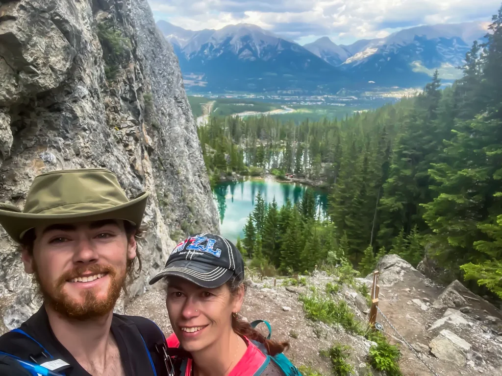
What stands out to me most about Kananaskis is how many different ways there are to experience the outdoors there. Whether I’m visiting with my senior mom, my super-hiker son, or my highly capable but uninterested teenage daughter, there is something for everyone. From challenging alpine trails, to refreshing lakes, paddling adventures, or scenic drives, there is an adventure for every ability level.
Planning and preparation can make a huge difference in how much you enjoy your trip. Understanding the different regions, choosing the right basecamp, preparing for changing mountain weather, and realistically planning your driving and hiking days all help create a smoother experience once you arrive.
We are incredibly blessed to have places like this to explore. Whether it’s watching morning fog lift off the mountains around Arethusa Cirque, spotting wildlife along the trail or beside the road, or standing on a windy alpine ridge after a long climb, places like Kananaskis are a reminder of the beauty, power, and creativity woven throughout creation. I am forever grateful for the privilege of exploring these landscapes the Lord created for us to experience and enjoy.
I hope this Kananaskis travel guide helps make planning your own trip a little easier, so you can spend less time trying to understand the map and more time fully experiencing everything this remarkable region has to offer.